The City of Santa Barbara’s Fire Department will be implementing the High Fire Hazard Vegetation Road Clearance Project starting on September 9, 2013. The work will continue through December, 2013. The roads to be completed are shown in the table below.
This year 14.5 miles of roads will be cleared through funds established by the Wildland Fire Suppression Assessment District in both the Extreme Foothill and Foothill Zone of the City’s high fire hazard area.
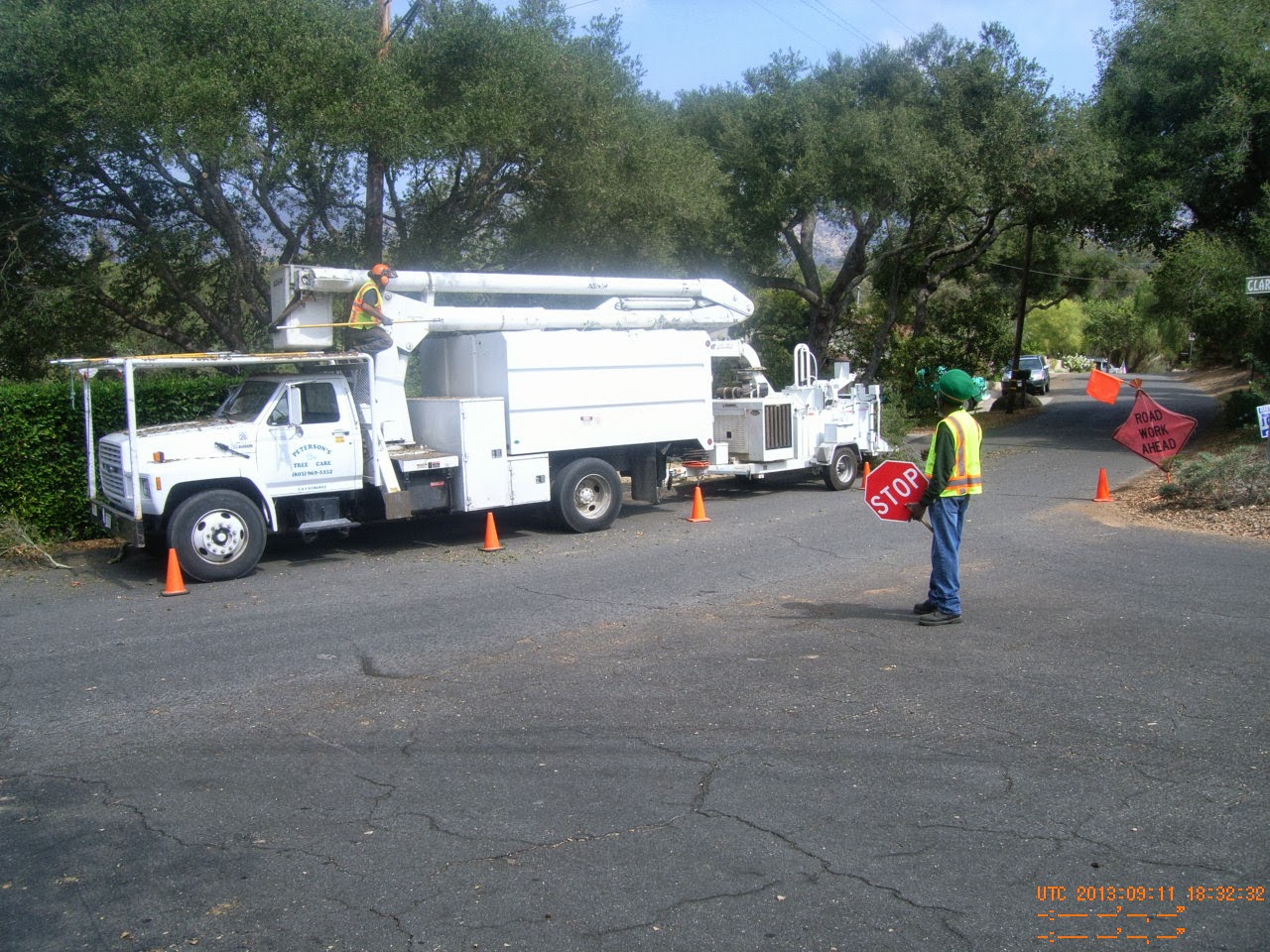
The purpose of vegetation road clearance is to reduce the total amount of vegetation along roadways, enhance evacuation during a wildland fire and allow greater access for fire engines and equipment to respond during a wildfire.
It is very important to maintain and keep up the work that has been completed. Maintaining roadways is not only important for your safety but the safety of the community.
Since the Fire Department is not able to complete every mile of road in the high fire hazard area on an annual basis, the maintenance of the road clearance work is the responsibility of each property owner. Santa Barbara Municipal Code requires homeowners to make sure that vegetation on their property does not encroach onto adjacent roadways. This effort includes keeping evacuation routes clear of flammable vegetation and thinning vegetation along the roadways.
In years past we have been able to recycle 98% of the chipped material and accomplished the same this year. If you have questions related to the project or have questions related to City property requirements you can call Chris Braden at 564-5737.
| Roads |
Description |
| SANTA TERESITADR |
From Santa Teresita Way to Ontare |
| N ONTARE RD |
From Foothill to Santa Teresita |
| CLAREMONT RD |
All of Claremont |
| PIEDMONT RD |
From Ontare to Claremont |
| CANYON ACRES DR |
All of Canyon Acres Dr |
| TREMONTO RD |
All of Tremonto |
| RIDGE LN |
All of Ridge Ln |
| LAS TUNAS RD |
All of Las Tunas |
| PATERNA RD |
From Lausen to Dover Rd |
| DOVER RD |
From Paterna to APS |
| DOVER HILL RD |
All of Dover Hill Rd |
| E PEDREGOSA ST |
From Grand to APS |
| E PEDREGOSA ST |
From Laguna to Grande Ave |
| MISSION RIDGE RD |
From Alvarado to San Carlos |
| APS |
From Pedregosa to Los Olivos |
| BONITA WY |
All of Bonita Way |
| LOMA ST |
From Pedregosa to Moreno |
| GRAND AVE |
From Bonita to Moreno |
| EMERSON AVE |
From Plaza Rubio to Pedregosa |
| PROSPECT AVE |
From Pedregosa to Valerio |
| E ISLAY ST |
From Prospect to Olive |
| GRAND AVE |
From Alta Vista to end of Grand (East Side of Grand) |
| E MICHELTORENA ST |
From Alta Vista to end of E. Micheltorena |
| N NOPAL ST |
All of N. Nopal |
| LOWENA DR |
From Anapamu to SB Bowl Parking Lot |
| EL CIELITO RD |
From Mountain to Mount Calvary |
| GIBRALTAR RD |
From El Cielito to Mountain |
| ROCKWOOD DR |
All of Rockwood |
| MISSION RIDGE RD |
From Mountain to Las Alturas |
| SYCAMORE CANYON RD |
From Stanwood to Coyote Rd |
| COYOTE RD |
From Sycamore Canyon to City Limits (731 Coyote Rd) |
| ORIZABA LN |
From Stanwood to Conjeo |
| CAMINO ALTO RD |
From Las Alturas to Conejo |
| LAS ALTURAS RD |
From Camino Alto to Alisal |
| DREXEL DR |
All of Drexel |
| FRANCESCHI RD |
All of Franceshi Rd |
| BARKER PASS RD |
From Eucalyptus Hill to City Limits ( 1925 Barker Pass) |
| CEDAR LN |
All of Cedar Ln |
| EUCALYPTUS HILL RD |
From Santa Ynez to Coronada Circle |
| CLIFTON ST |
From Santa Ynez to Eucalyptus Hill |
| ALSTON RD |
From Eucalyptus Hill Rd to City Limits (1011 Alston RD) |
| ALSTON PL |
All of Alston Place |
| DEERPATH RD |
All of Deerpath Rd |
| CIMA LINDA LN |
All of Cima Linda Ln |
| OWEN RD |
All of Owen Rd |
| SUMMIT RD |
From Alston to Rametto |
| CAMINO VIEJO RD |
From El Rancho to City Limits (940 Camino Viejo) |
ALAMEDA PADRE
SERRA |
From Terrace Vista to Eucalyptus Hill |
| TERRACE VISTA LN |
All of Terrace Vista |